Tel: (707) 837-7900 | Contact Us
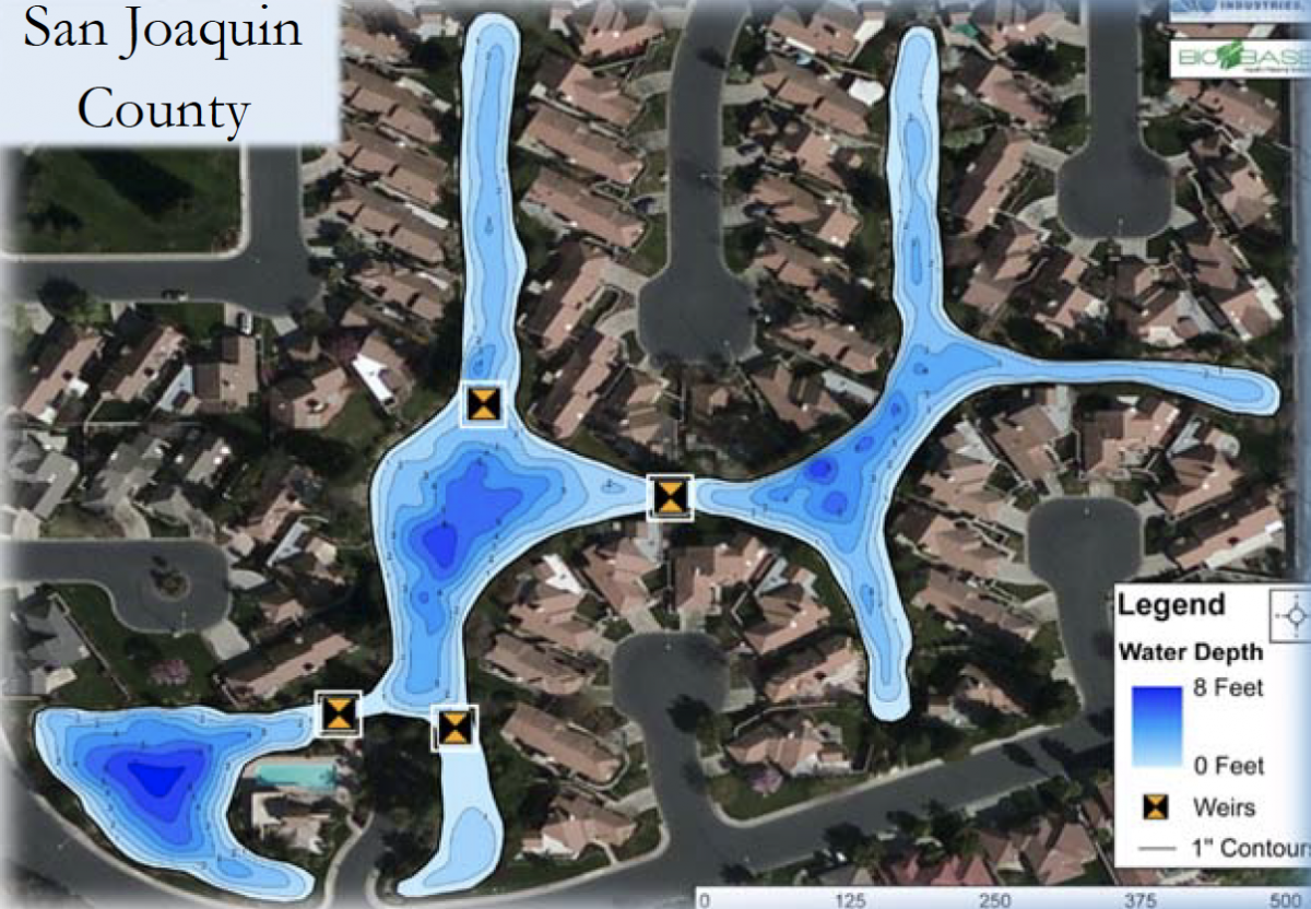
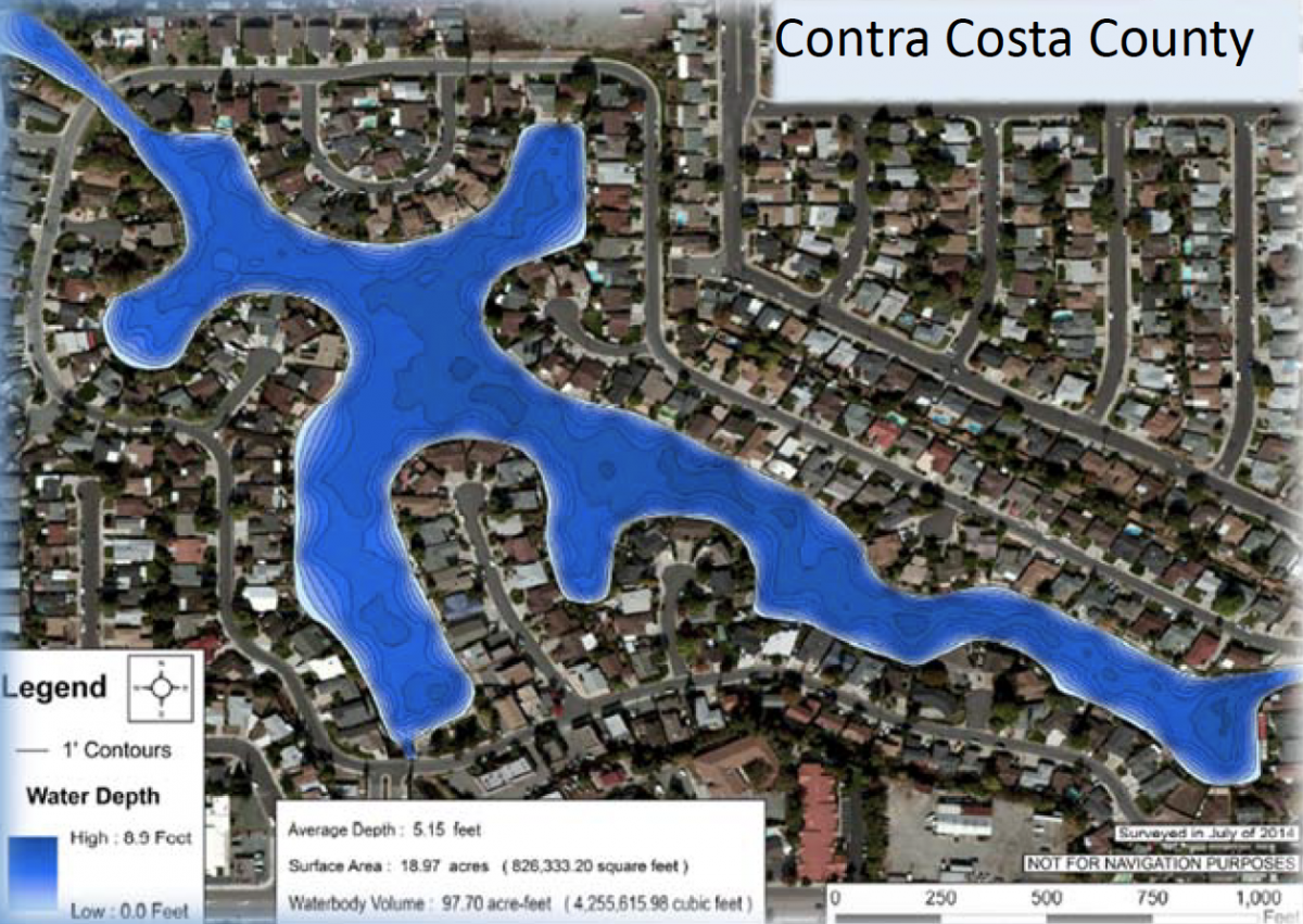
Bathymetric and Aquatic Vegetation Mapping
Waterworks Industries, Inc. uses state of the art equipment and the latest technological innovations to provide bathymetric and aquatic vegetation maps that ensure precision and accuracy for the management of your water body. Outlined below are several of the benefits provided by having a bathymetric map or aquatic vegetation map created for your system.
Calculate the volume of water in your system in order to more accurately determine water storage capacity, and monitor drought conditions.
 Use bathymetry to monitor sedimentation rate and to ensure the success of dredging projects. This is done by collecting data pre and post project to confirm the changes in depth and to verify the amount of sediment removed. Aquatic vegetation maps can be created to assist in aquatic weed control management strategies such as using water volume data to assist in determining precise aquatic herbicide and algaecide treatment rates, identifying target treatment areas, and monitoring post treatment efficacy.